Snake River Plain Geothermal Play Fairway Analysis Heat, Permeability, and Seal CRS Map Raster Files

Snake River Plain Play Fairway Analysis - Phase 1 CRS Raster Files.
This dataset contains raster files created in ArcGIS. These raster images depict Common Risk Segment (CRS) maps for HEAT, PERMEABILITY, AND SEAL, as well as selected maps of Evidence Layers. These evidence layers consist of either Bayesian krige functions or kernel density functions, and include:
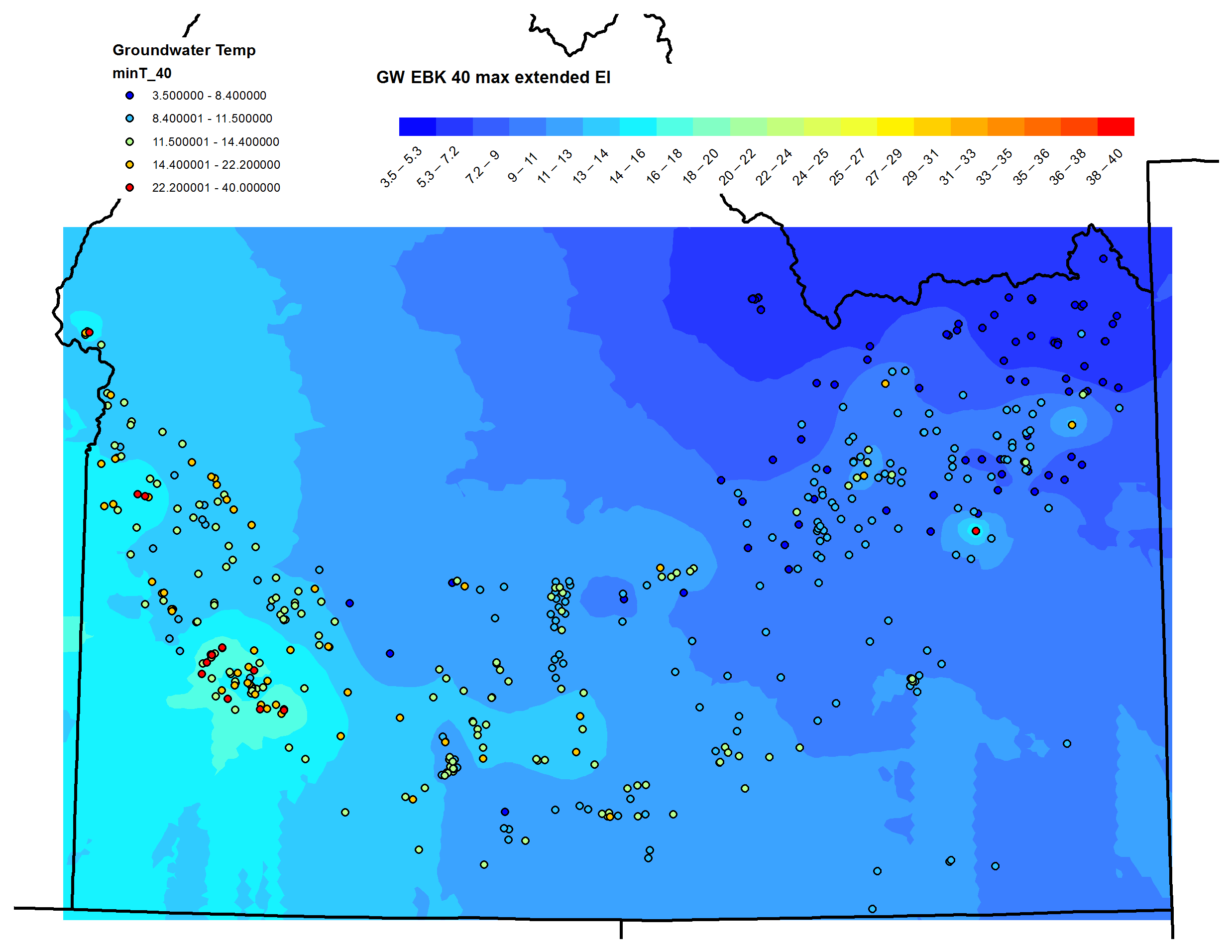
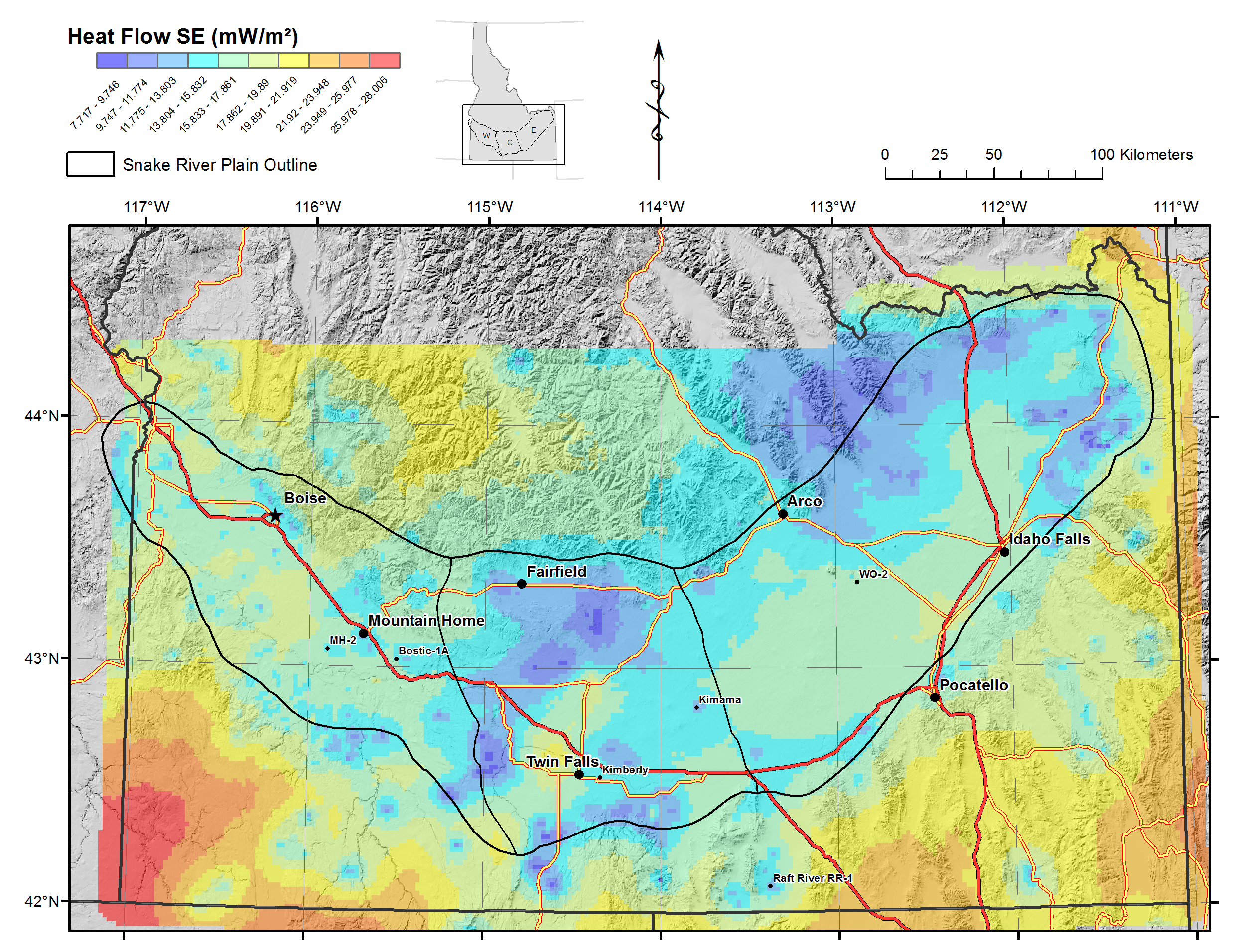
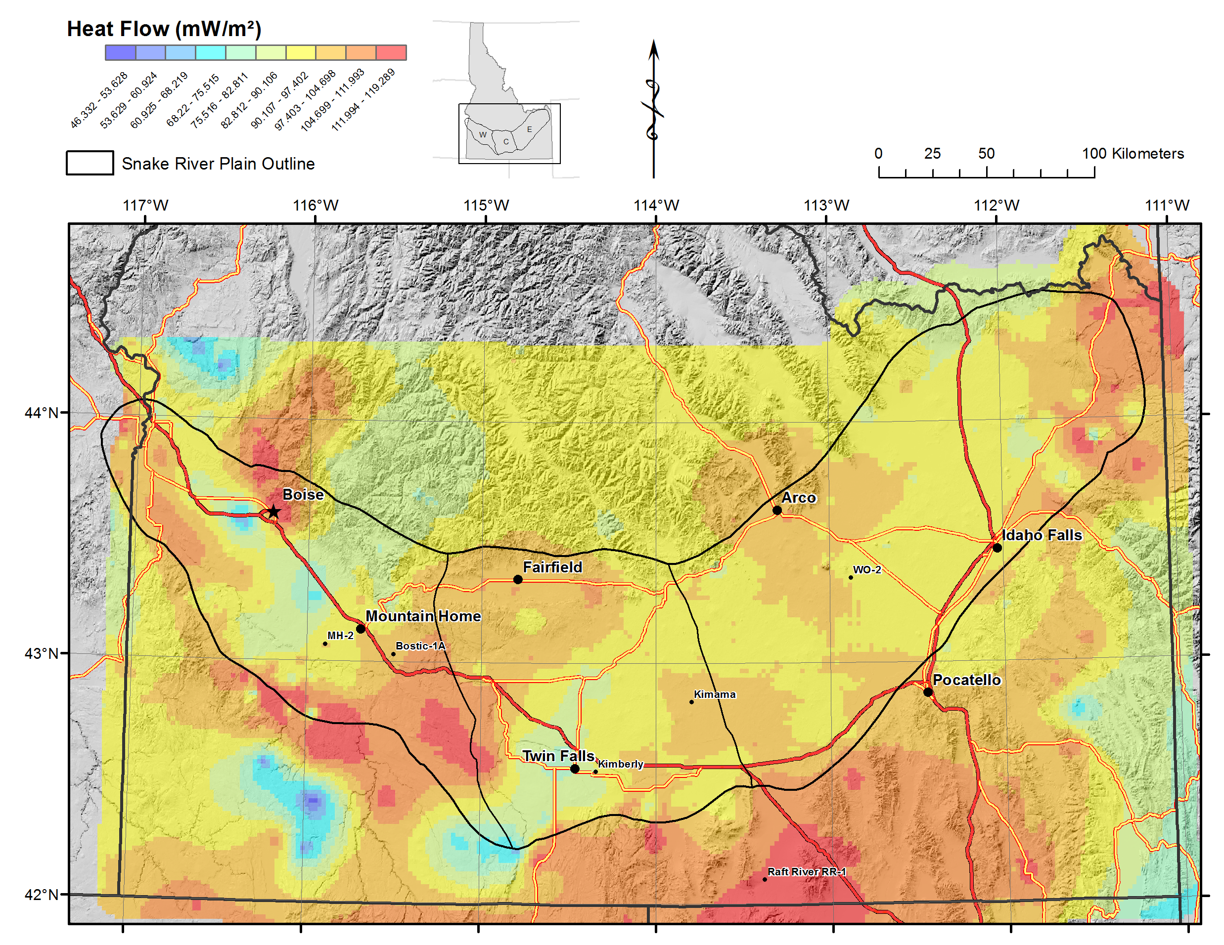
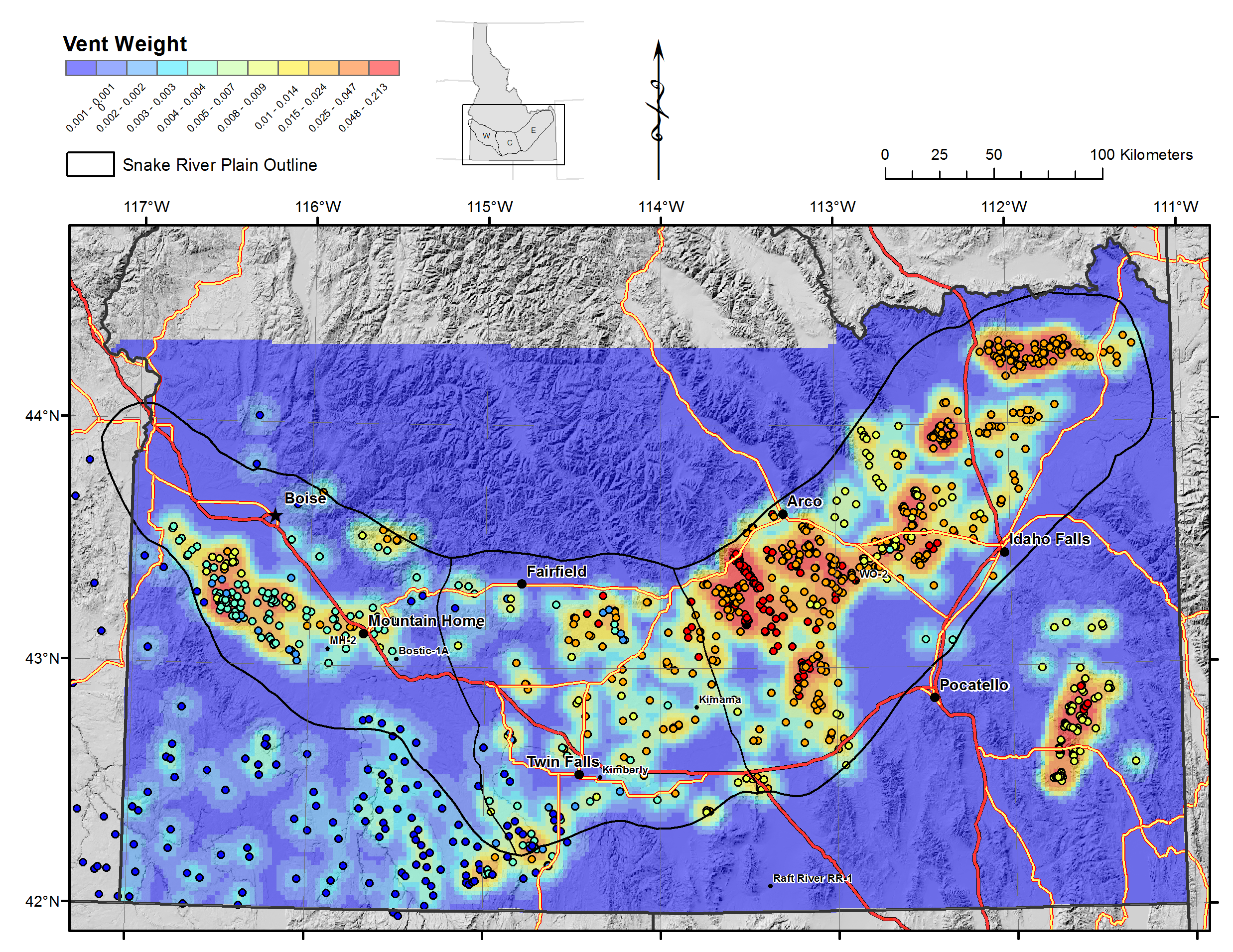
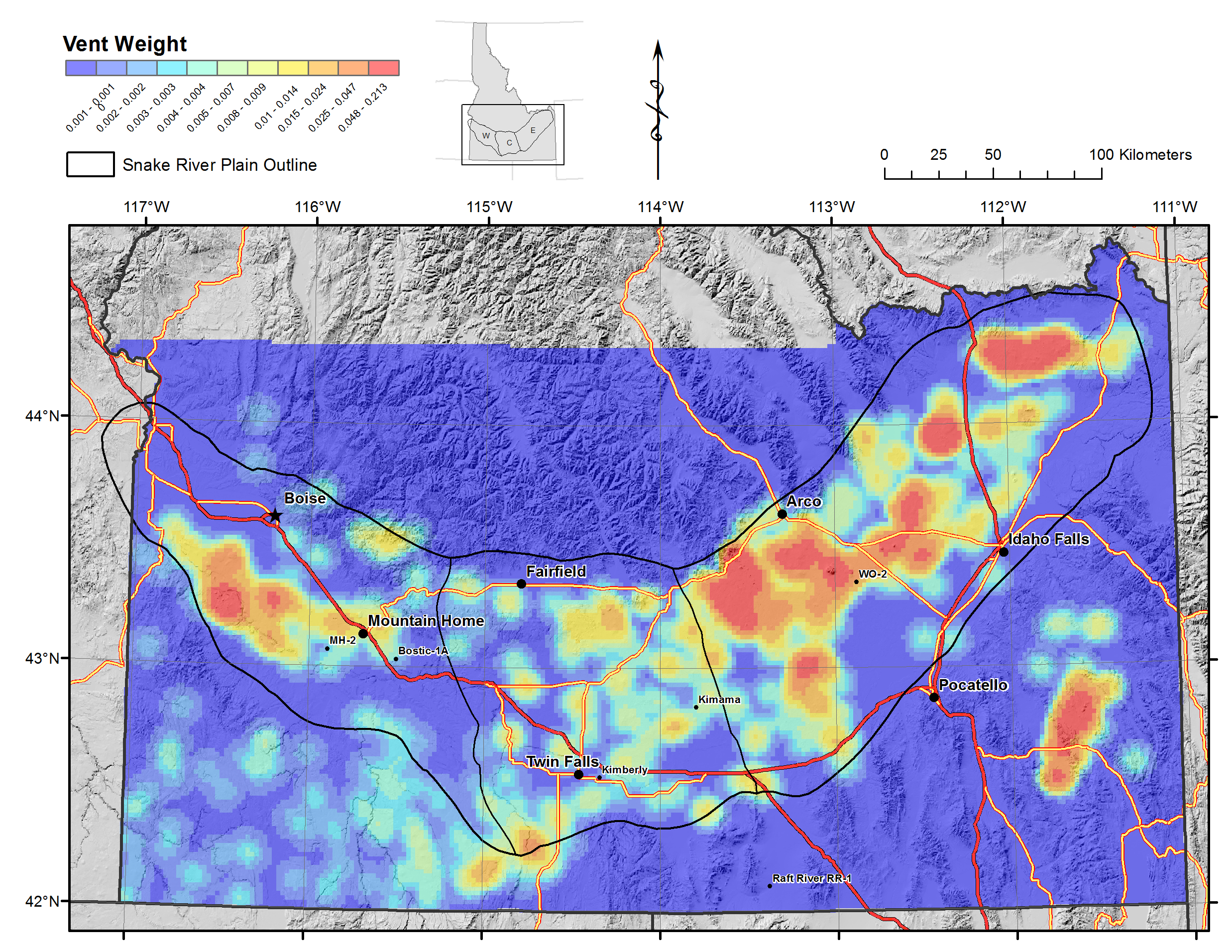
(1) HEAT: Heat flow (Bayesian krige map), Heat flow standard error on the krige function (data confidence), volcanic vent distribution as function of age and size, groundwater temperature (equivalue interval and natural breaks bins), and groundwater T standard error.
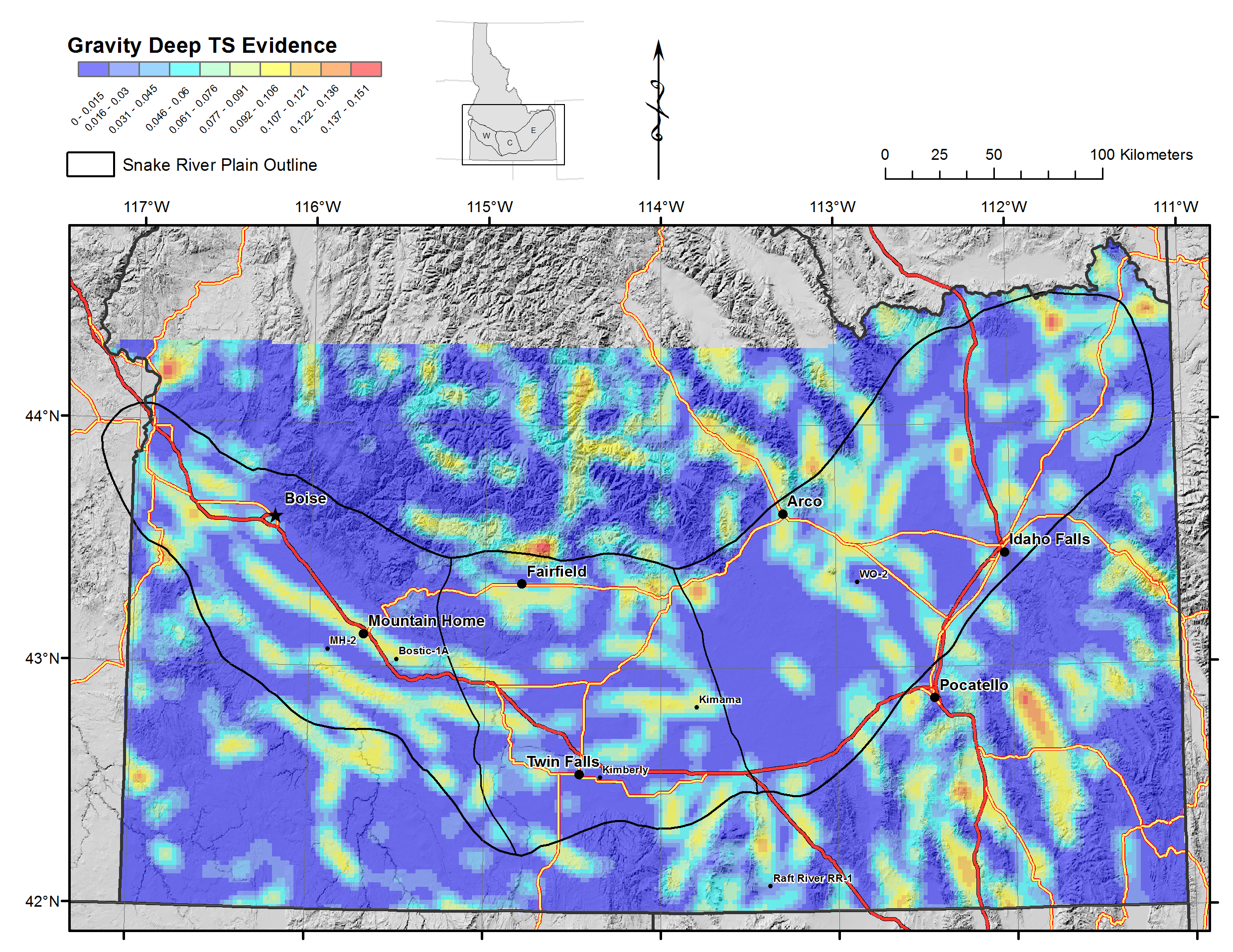
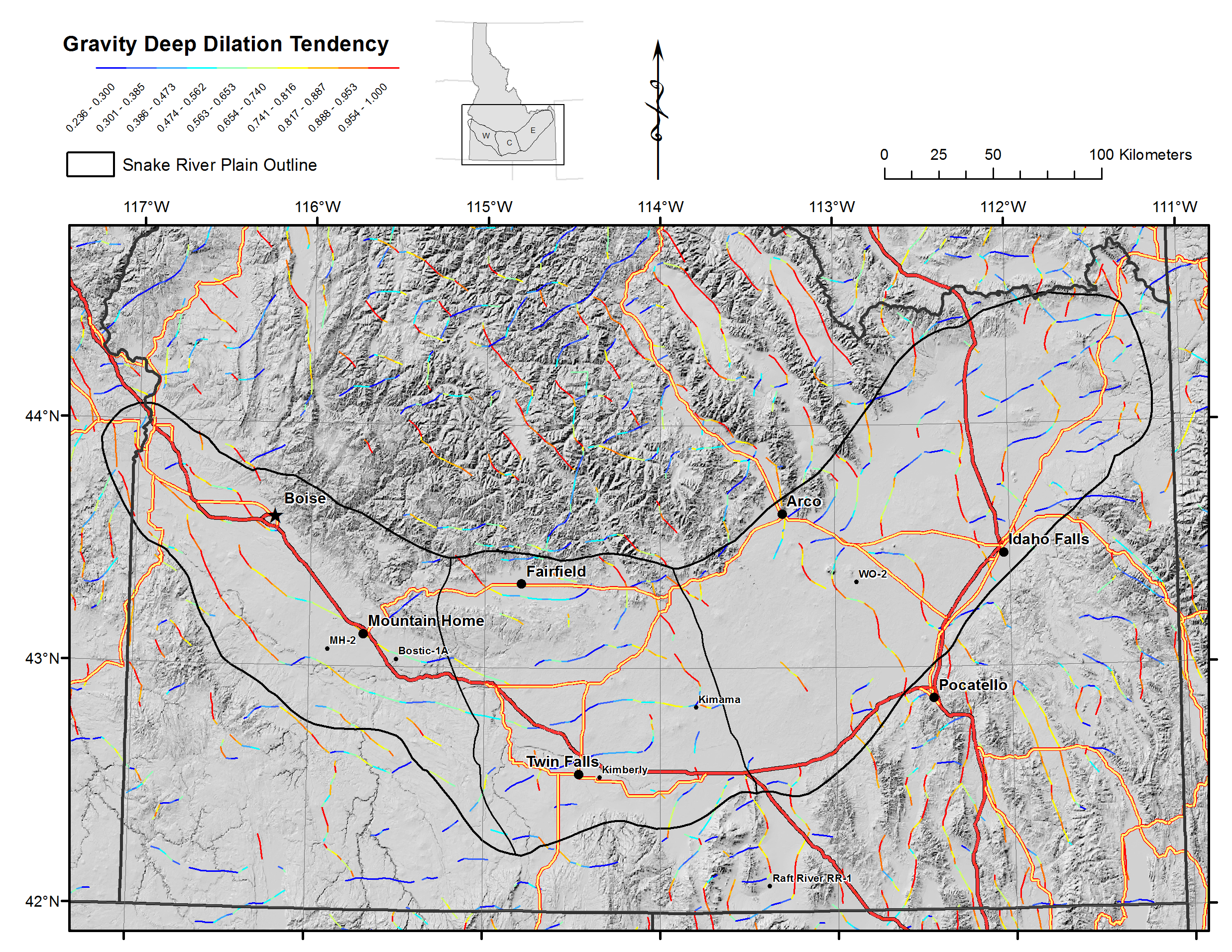
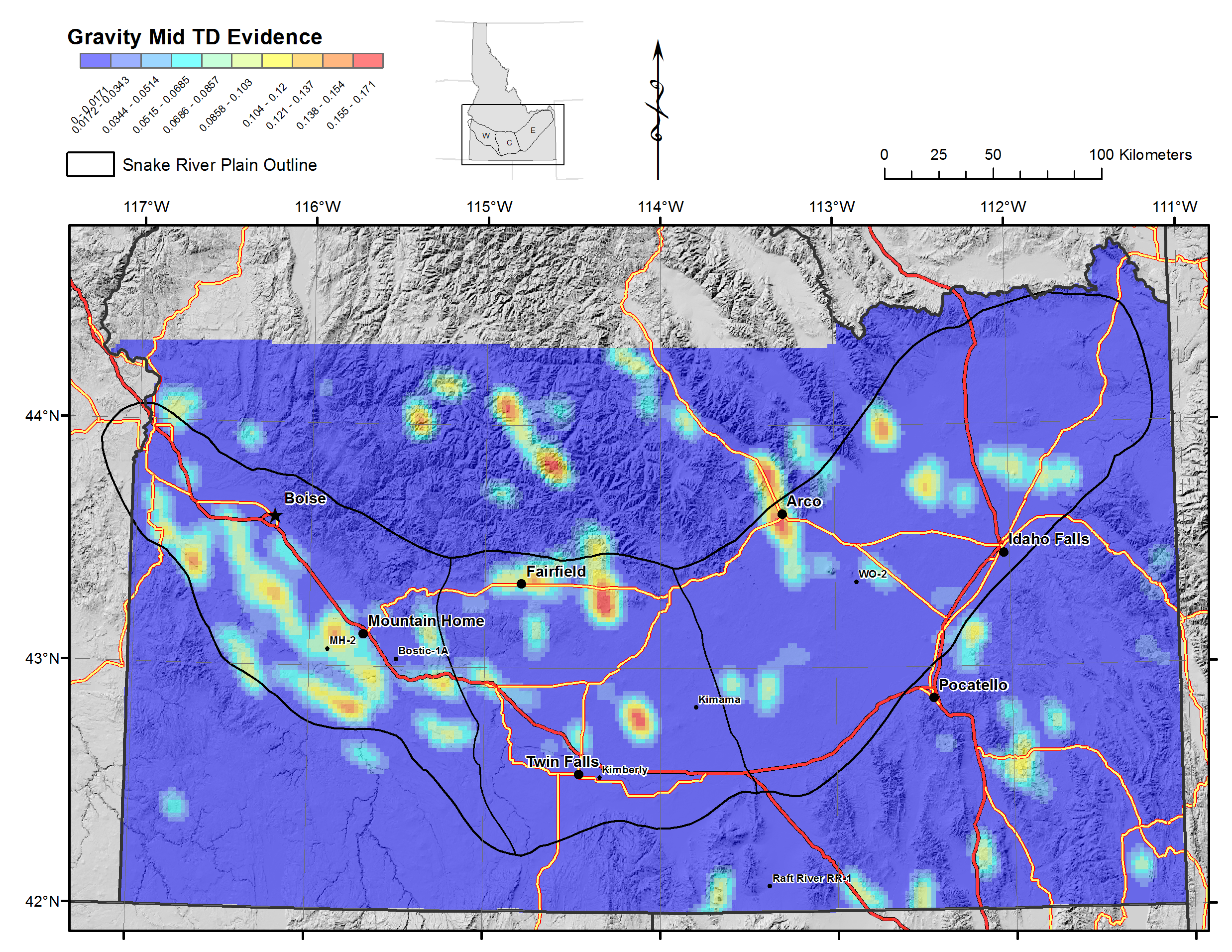
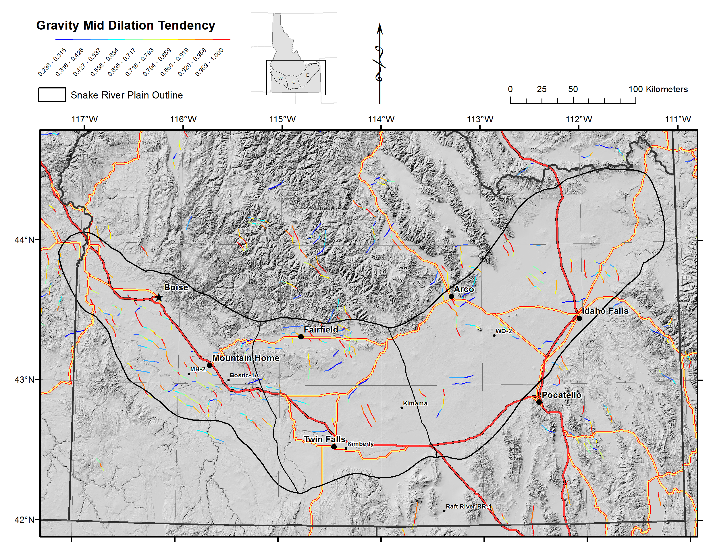
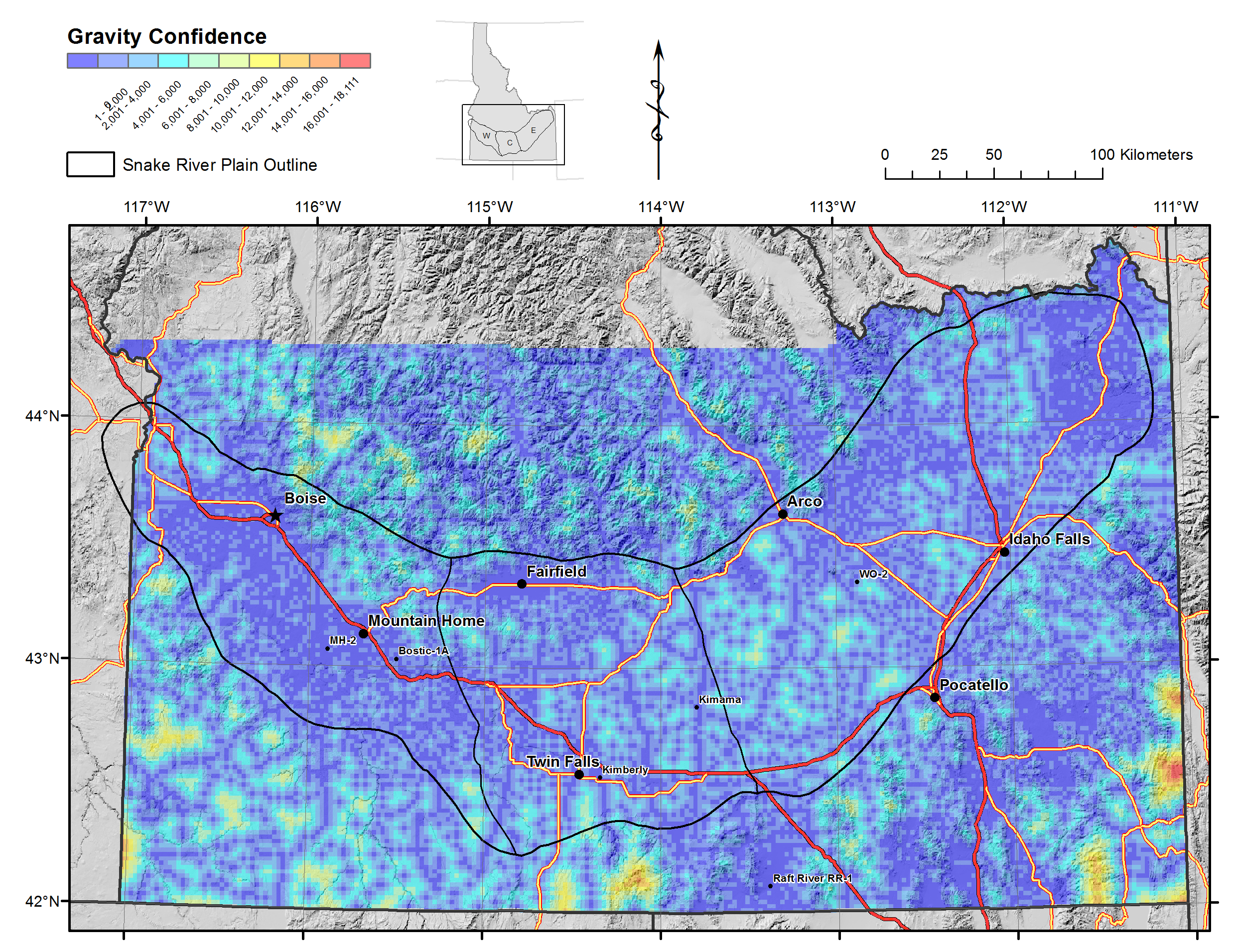
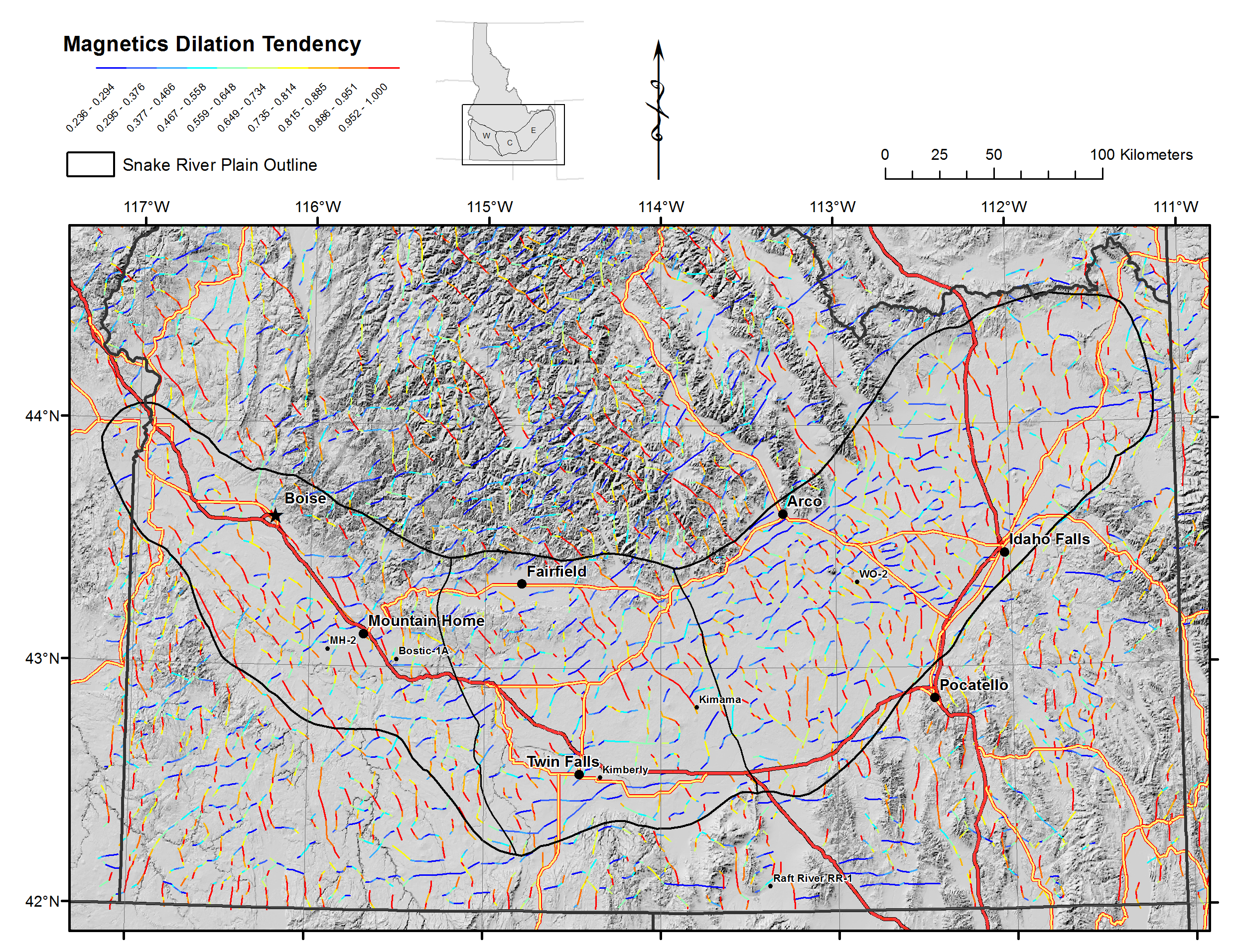
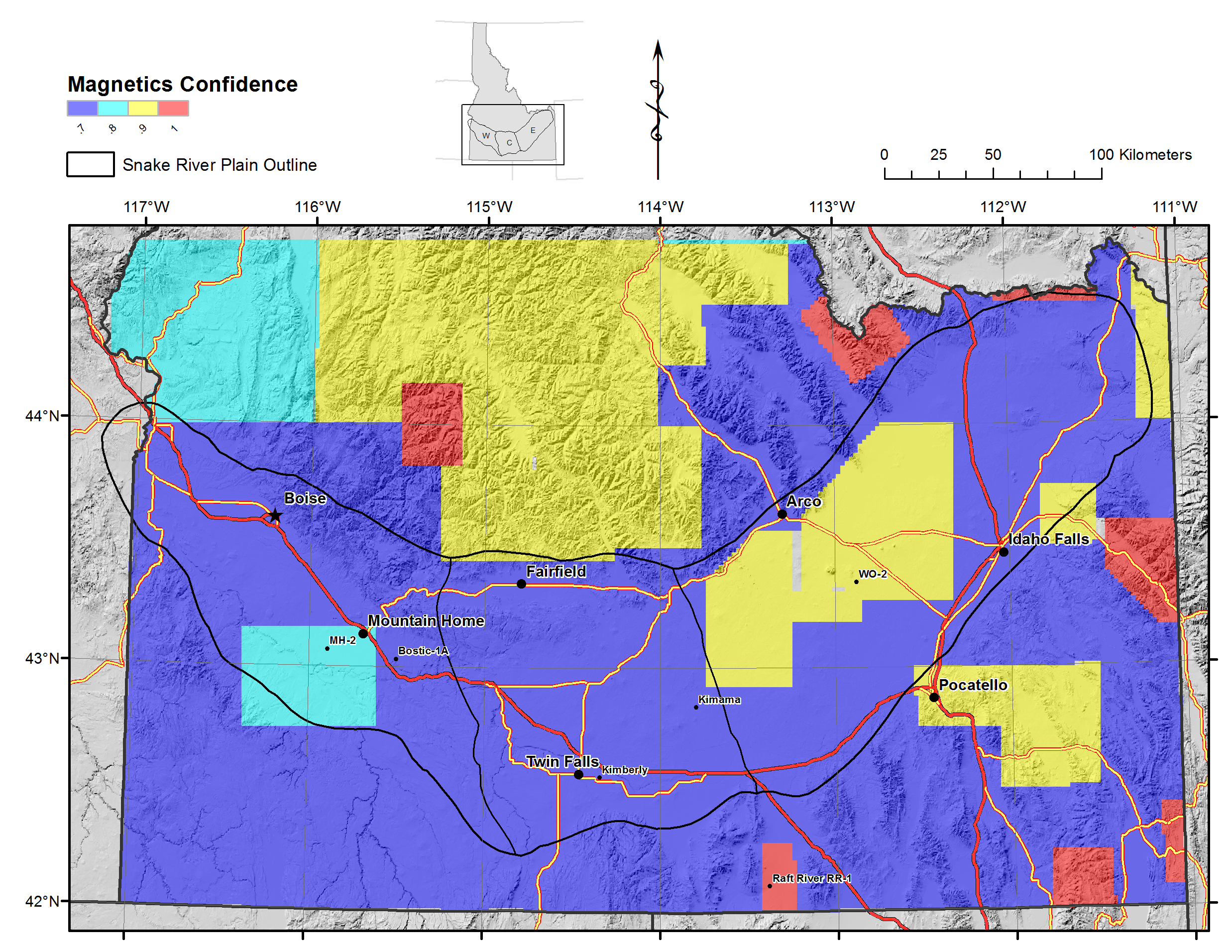
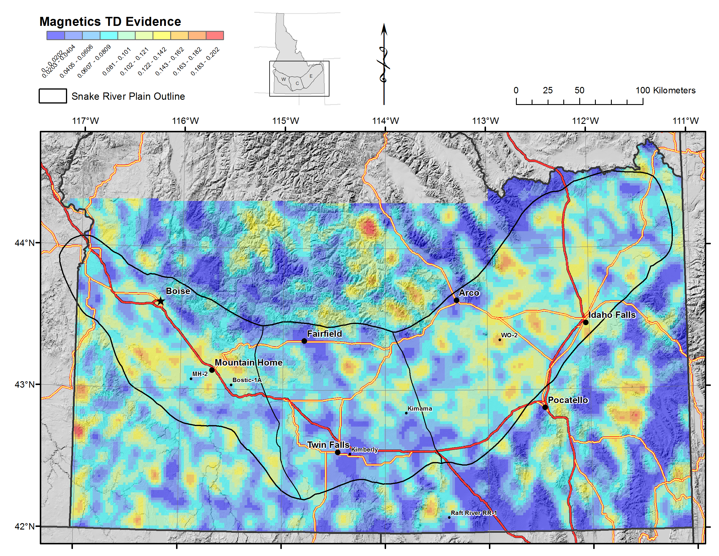
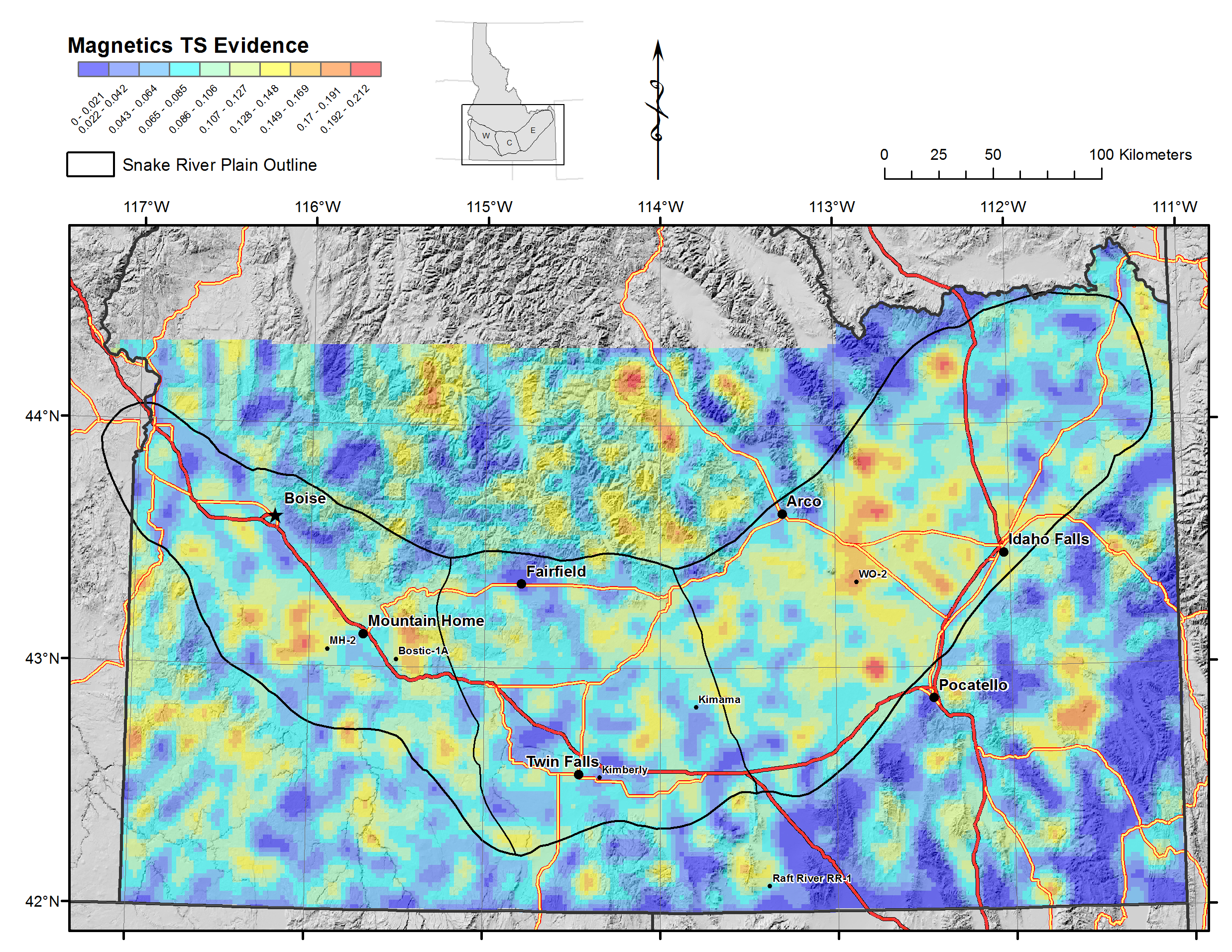
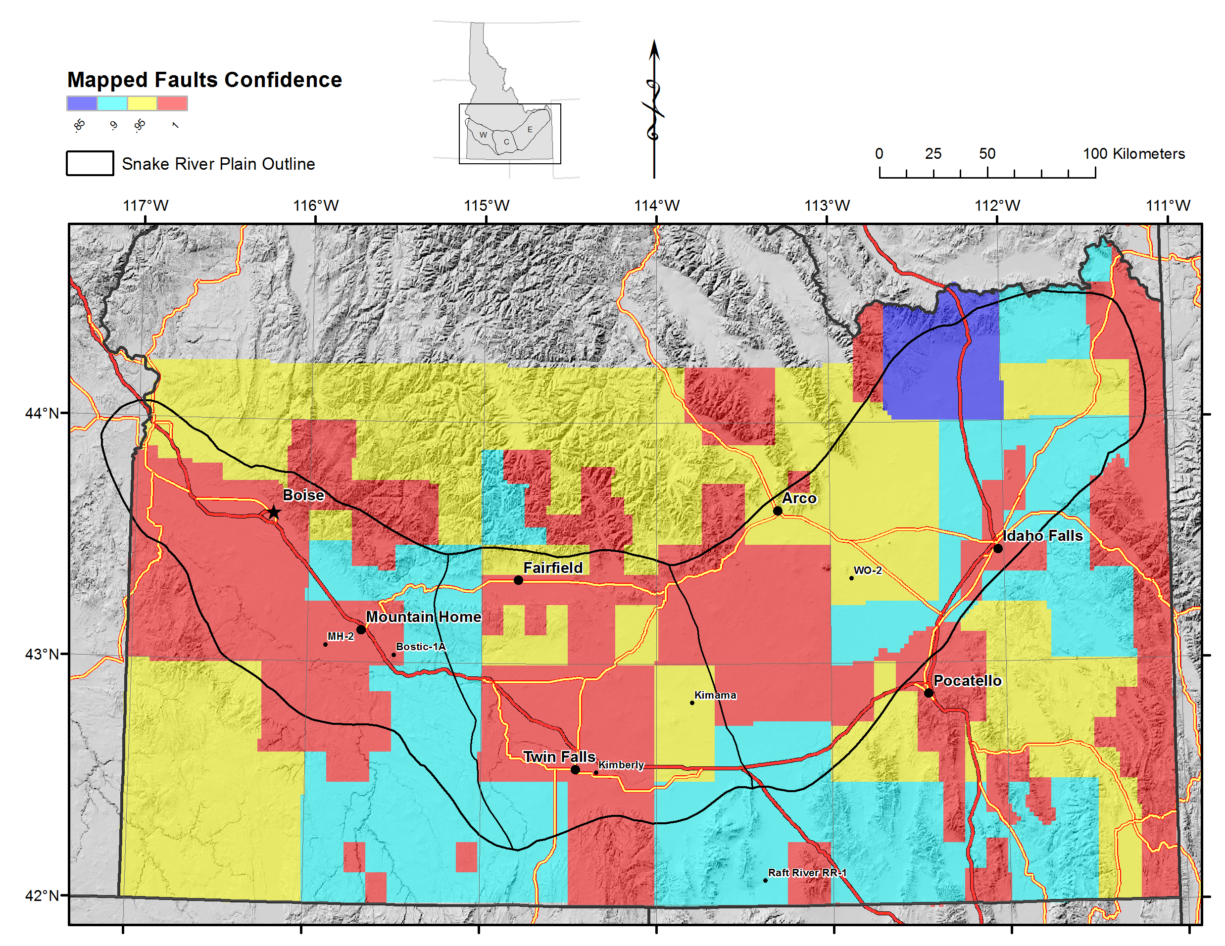
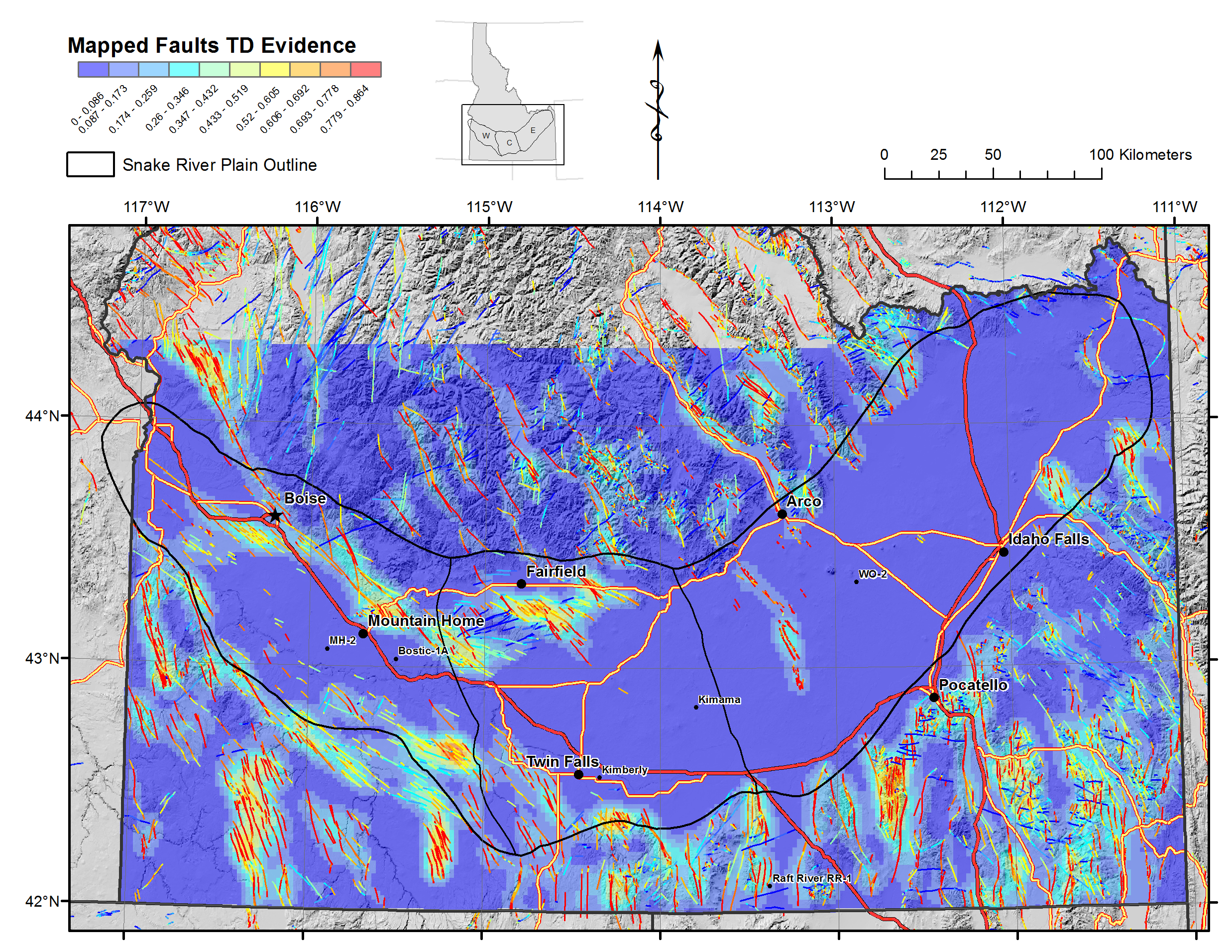
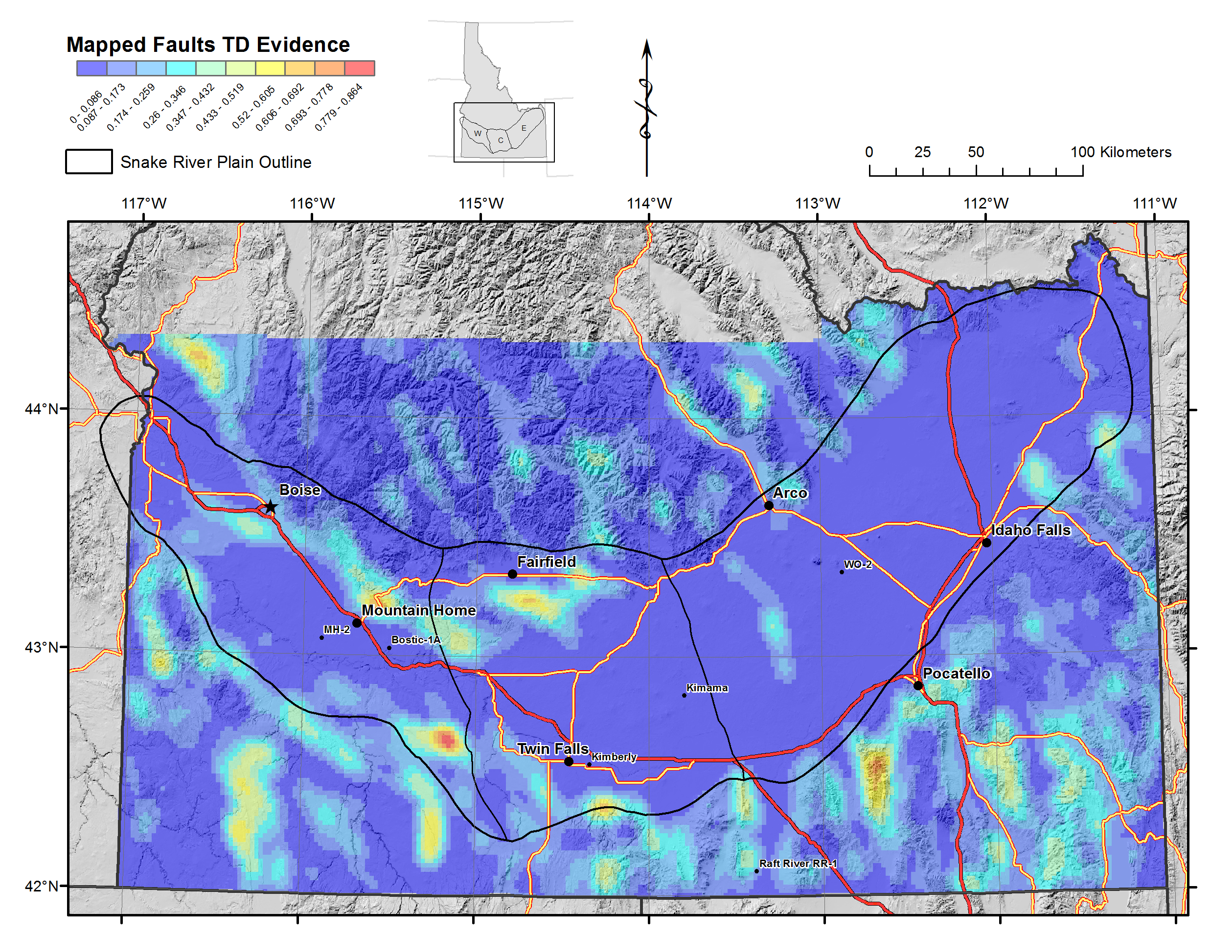
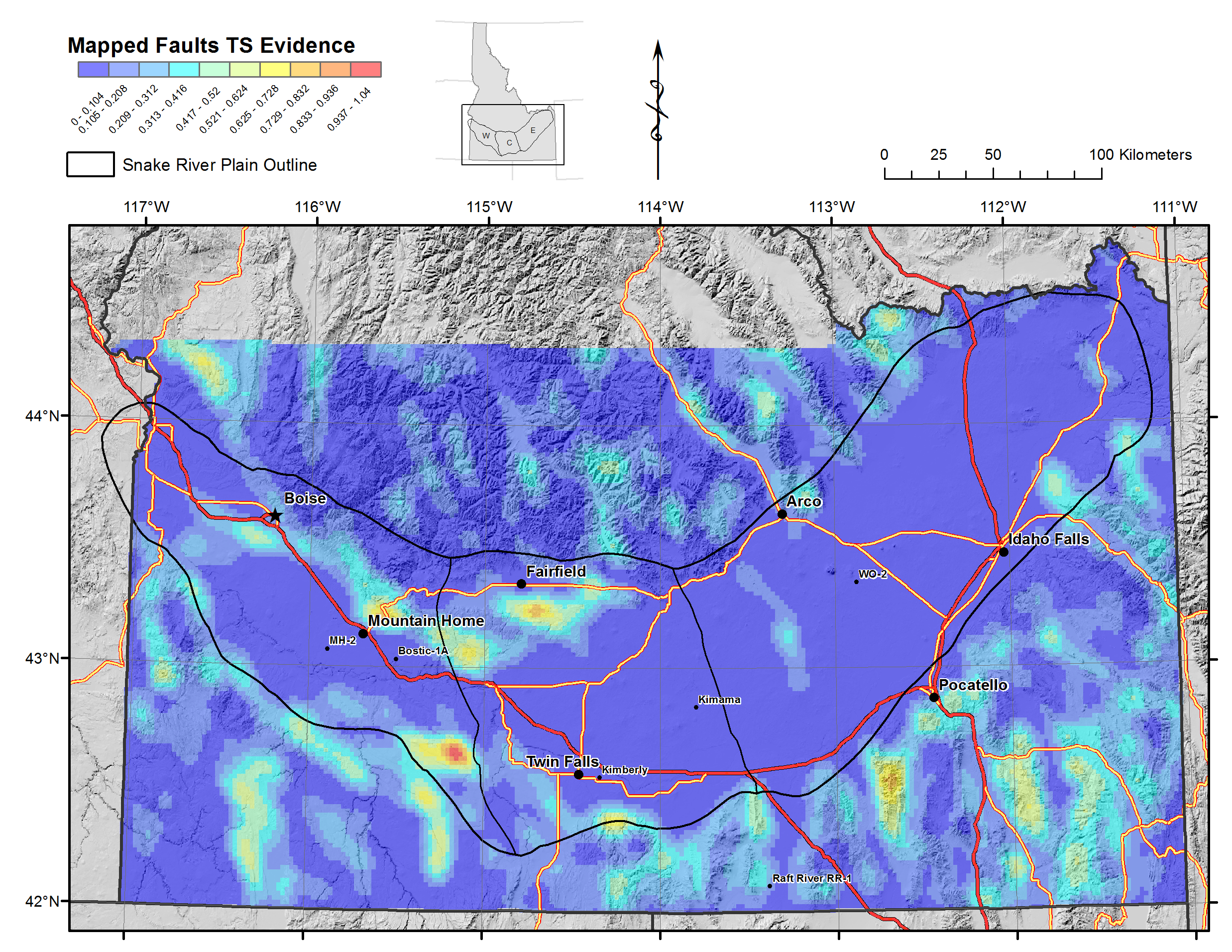
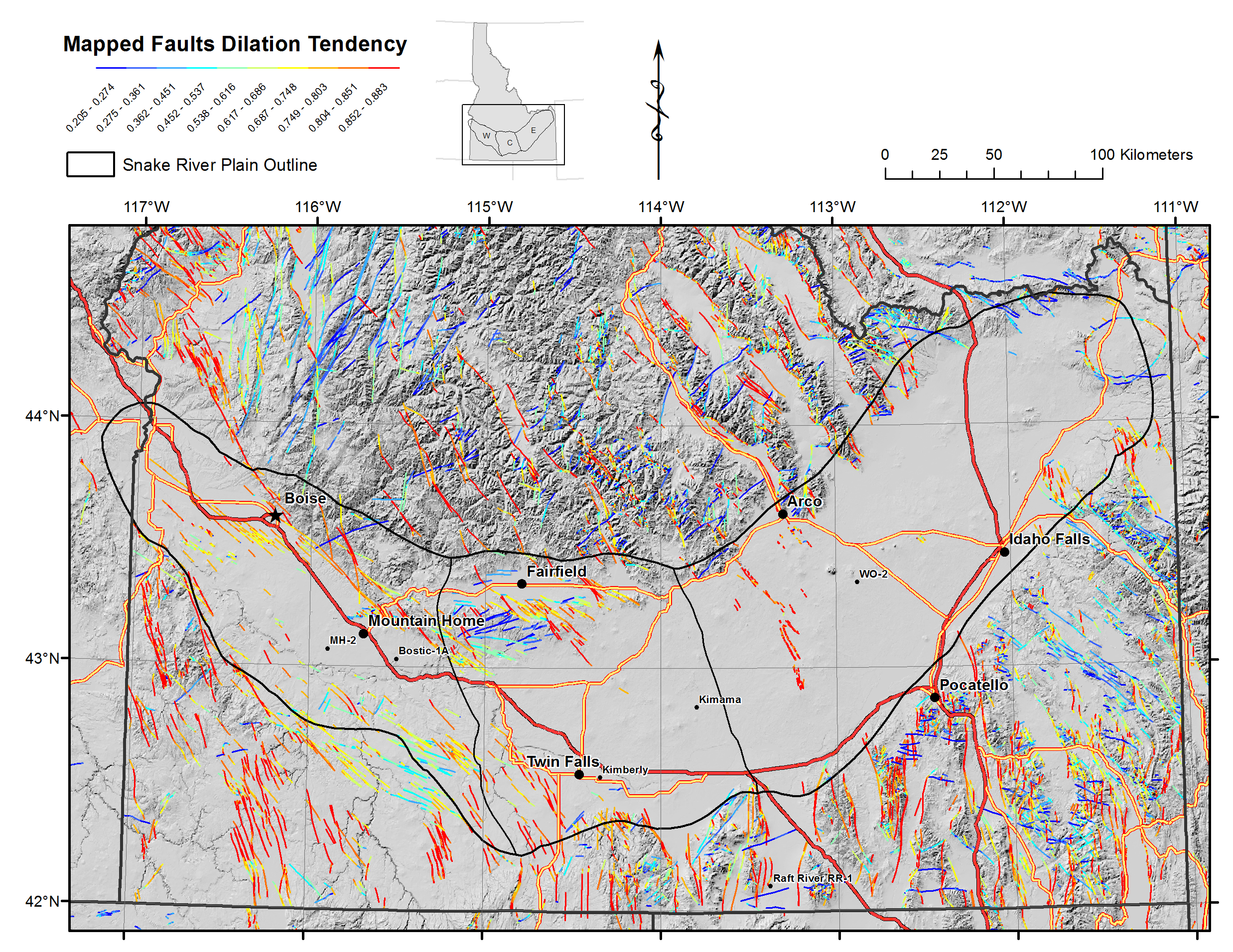
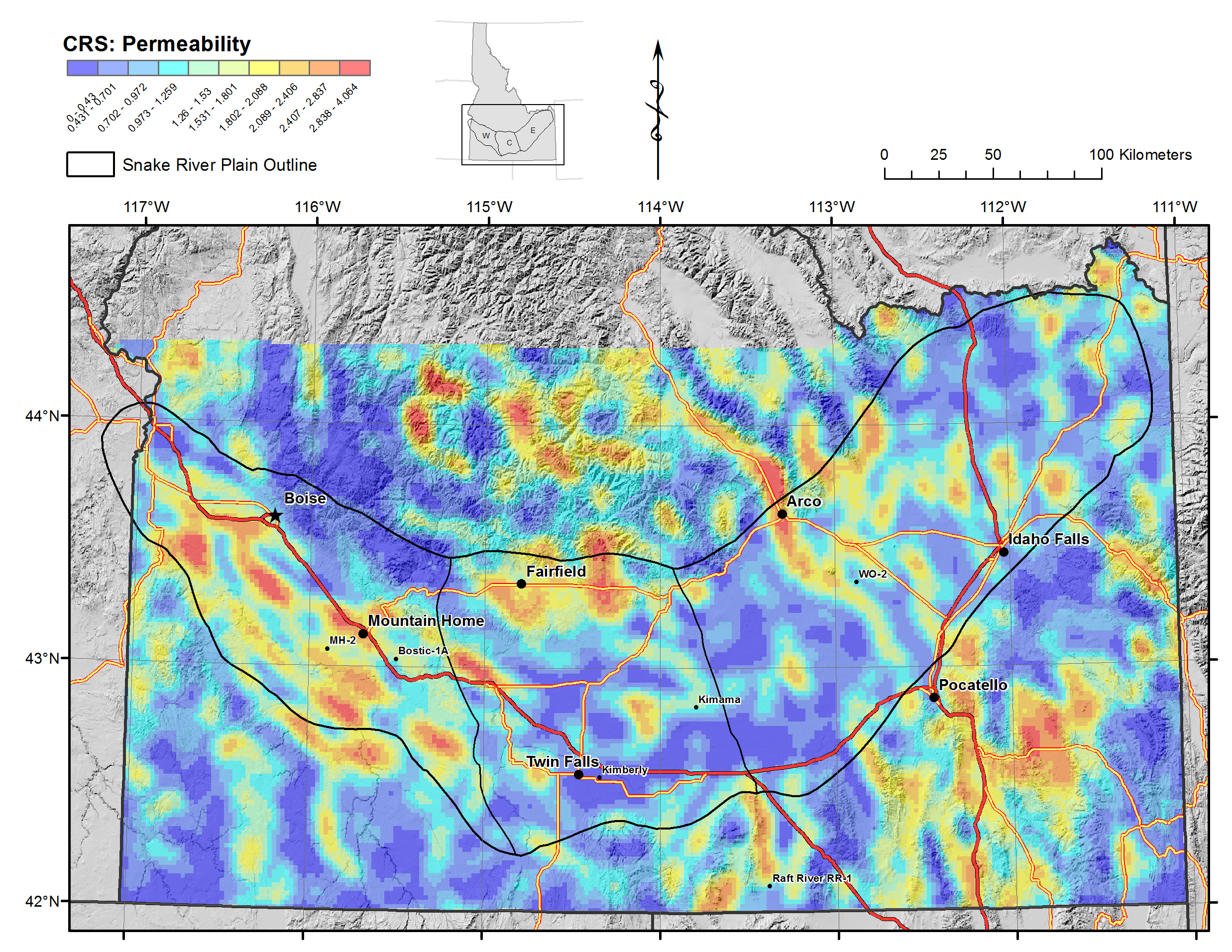
(2) PERMEABILTY: Fault and lineament maps, both as mapped and as kernel density functions, processed for both dilational tendency (TD) and slip tendency (ST), along with data confidence maps for each data type. Data types include mapped surface faults from USGS and Idaho Geological Survey data bases, as well as unpublished mapping; lineations derived from maximum gradients in magnetic, deep gravity, and intermediate depth gravity anomalies.
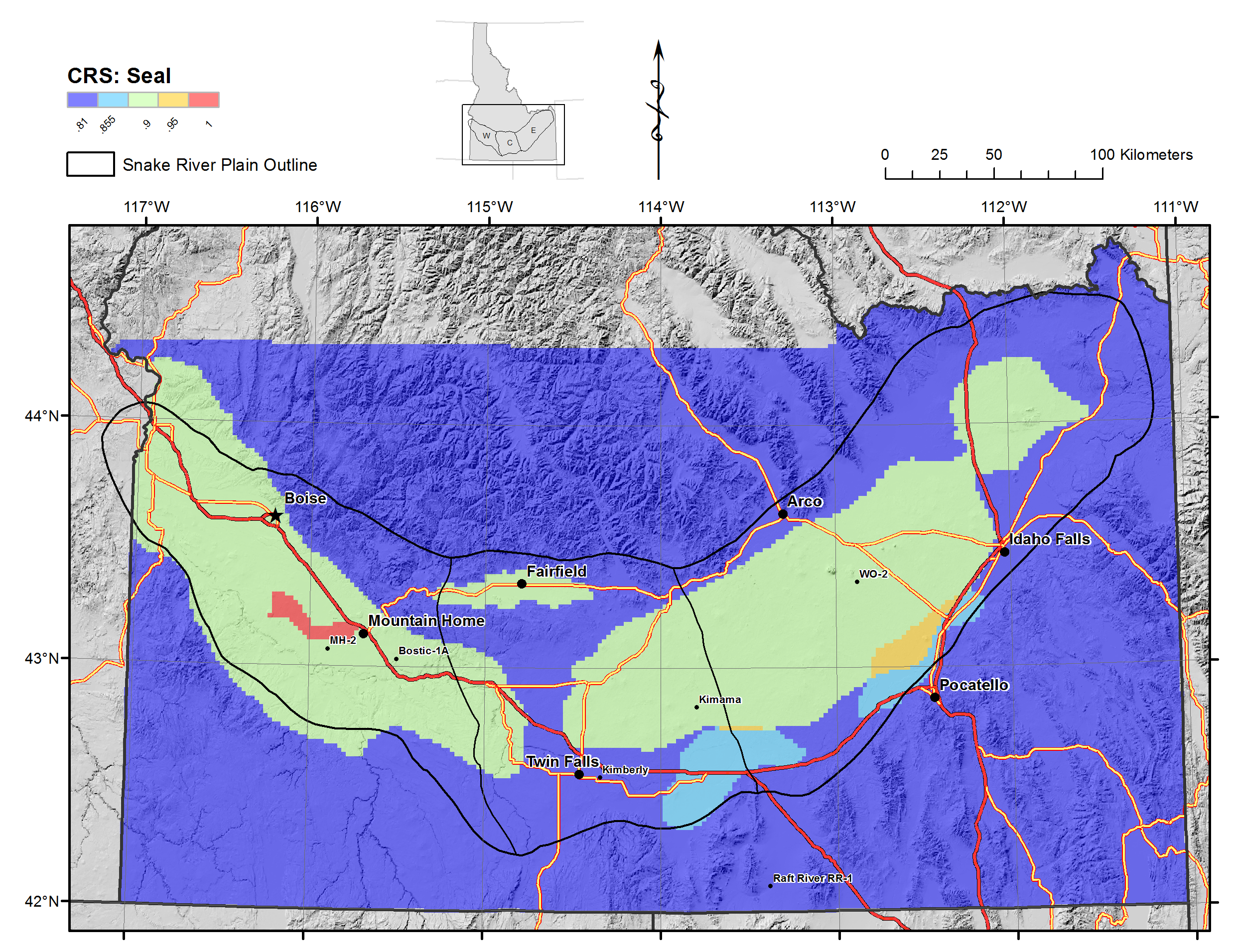
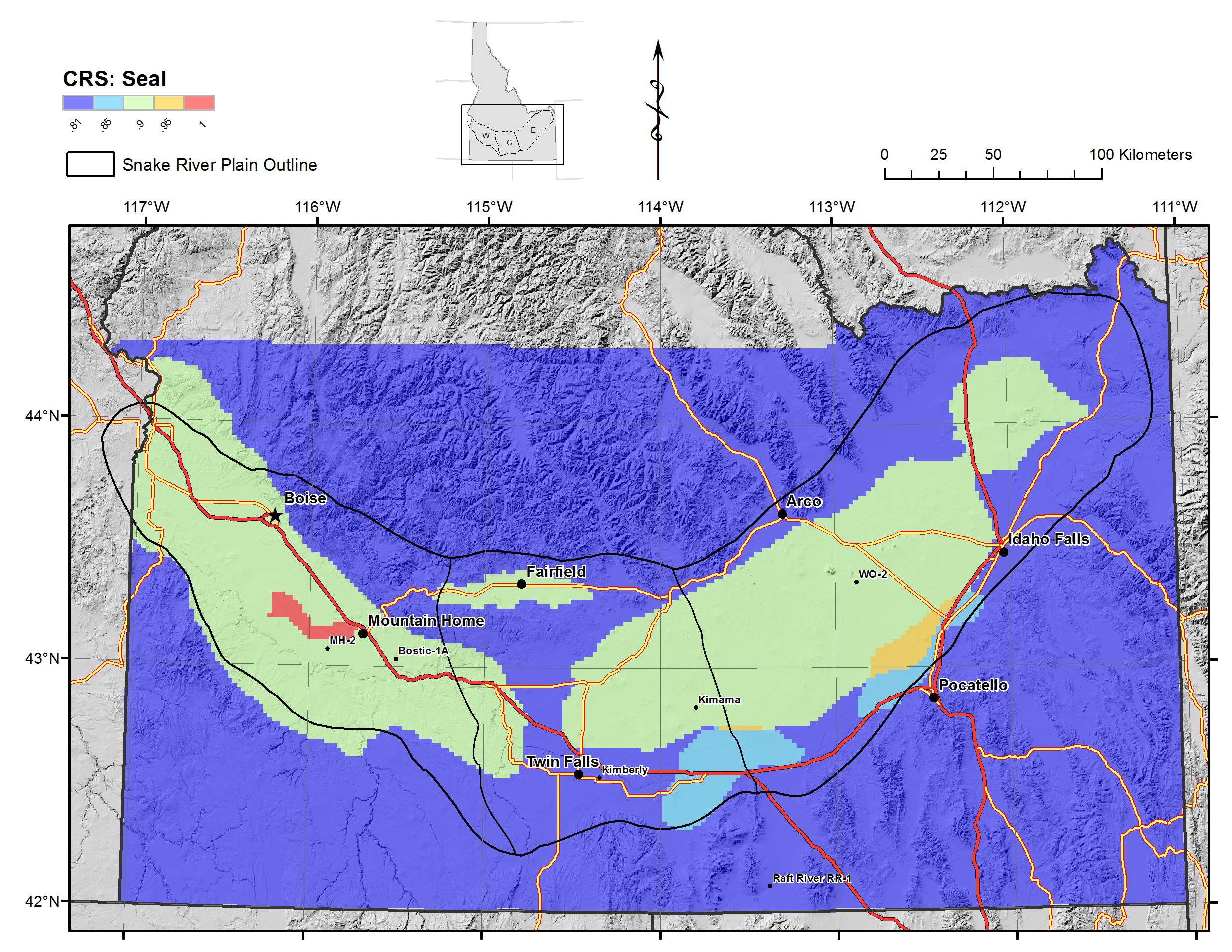
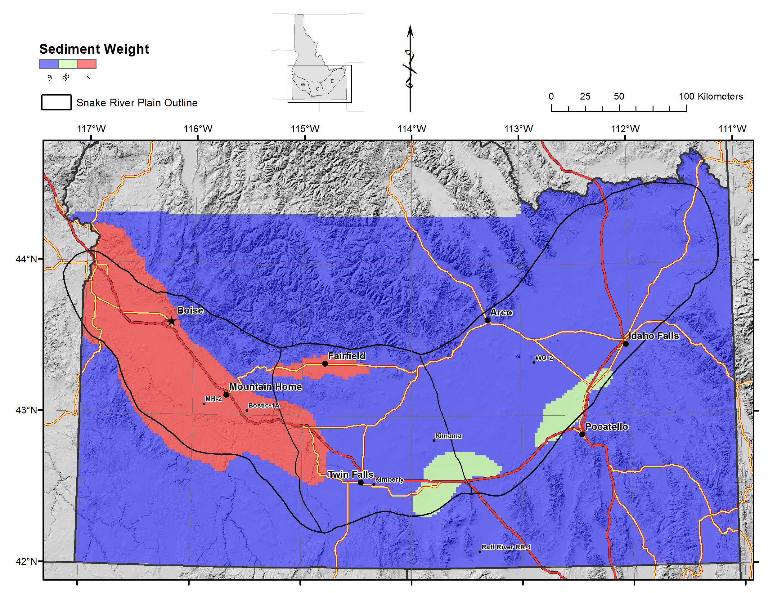
(3) SEAL: Seal maps based on presence and thickness of lacustrine sediments and base of SRP aquifer.
Raster size is 2 km. All files generated in ArcGIS.
Citation Formats
TY  - DATA
AB  - Snake River Plain Play Fairway Analysis - Phase 1 CRS Raster Files.
This dataset contains raster files created in ArcGIS. These raster images depict Common Risk Segment (CRS) maps for HEAT, PERMEABILITY, AND SEAL, as well as selected maps of Evidence Layers. These evidence layers consist of either Bayesian krige functions or kernel density functions, and  include:
(1) HEAT: Heat flow (Bayesian krige map), Heat flow standard error on the krige function (data confidence), volcanic vent distribution as function of age and size, groundwater temperature (equivalue interval and natural breaks bins), and groundwater T standard error.
(2) PERMEABILTY: Fault and lineament maps, both as mapped and as kernel density functions, processed for both dilational tendency (TD) and slip tendency (ST), along with data confidence maps for each data type. Data types include mapped surface faults from USGS and Idaho Geological Survey data bases, as well as unpublished mapping; lineations derived from maximum gradients in magnetic, deep gravity, and intermediate depth gravity anomalies.
(3) SEAL: Seal maps based on presence and thickness of lacustrine sediments and base of SRP aquifer.
Raster size is 2 km. All files generated in ArcGIS.
AU  - Shervais, John
DB  - Open Energy Data Initiative (OEDI)
DP  - Open EI | National Renewable Energy Laboratory
DO  - 10.15121/1254474
KW  - geothermal
KW  - Snake River Plain
KW  - Idaho
KW  - Play Fairway Analysis
KW  - pfa
KW  - groundwater temperature
KW  - resource assessment
KW  - site characterization
KW  - heat
KW  - permeability
KW  - seal
KW  - gravity
KW  - magnetic
KW  - dilation tendancy
KW  - faulting
KW  - faults
KW  - heat source
KW  - vent
KW  - sediment
KW  - slip tendancy
KW  - aquifer
KW  - srp
LA  - English
DA  - 2015/10/09
PY  - 2015
PB  - Utah State University
T1  - Snake River Plain Geothermal Play Fairway Analysis Heat, Permeability, and Seal CRS Map Raster Files
UR  - https://doi.org/10.15121/1254474
ER  -
Shervais, John. Snake River Plain Geothermal Play Fairway Analysis Heat, Permeability, and Seal CRS Map Raster Files. Utah State University, 9 October, 2015, GDR. https://doi.org/10.15121/1254474.
Shervais, J. (2015). Snake River Plain Geothermal Play Fairway Analysis Heat, Permeability, and Seal CRS Map Raster Files. [Data set]. GDR. Utah State University. https://doi.org/10.15121/1254474
Shervais, John. Snake River Plain Geothermal Play Fairway Analysis Heat, Permeability, and Seal CRS Map Raster Files. Utah State University, October, 9, 2015. Distributed by GDR. https://doi.org/10.15121/1254474
@misc{OEDI_Dataset_6952,
title = {Snake River Plain Geothermal Play Fairway Analysis Heat, Permeability, and Seal CRS Map Raster Files},
author = {Shervais, John},
abstractNote = {Snake River Plain Play Fairway Analysis - Phase 1 CRS Raster Files.

This dataset contains raster files created in ArcGIS. These raster images depict Common Risk Segment (CRS) maps for HEAT, PERMEABILITY, AND SEAL, as well as selected maps of Evidence Layers. These evidence layers consist of either Bayesian krige functions or kernel density functions, and  include:

(1) HEAT: Heat flow (Bayesian krige map), Heat flow standard error on the krige function (data confidence), volcanic vent distribution as function of age and size, groundwater temperature (equivalue interval and natural breaks bins), and groundwater T standard error.

(2) PERMEABILTY: Fault and lineament maps, both as mapped and as kernel density functions, processed for both dilational tendency (TD) and slip tendency (ST), along with data confidence maps for each data type. Data types include mapped surface faults from USGS and Idaho Geological Survey data bases, as well as unpublished mapping; lineations derived from maximum gradients in magnetic, deep gravity, and intermediate depth gravity anomalies.

(3) SEAL: Seal maps based on presence and thickness of lacustrine sediments and base of SRP aquifer.

Raster size is 2 km. All files generated in ArcGIS. },
url = {https://gdr.openei.org/submissions/733},
year = {2015},
howpublished = {GDR, Utah State University, https://doi.org/10.15121/1254474},
note = {Accessed: 2026-01-03},
doi = {10.15121/1254474}
}
https://dx.doi.org/10.15121/1254474
Details
Data from Oct 9, 2015
Last updated Jan 8, 2020
Submitted Mar 25, 2016
Organization
Utah State University
Contact
John Shervais
435.797.1274
Authors
Original Source
https://gdr.openei.org/submissions/733Research Areas
Keywords
geothermal, Snake River Plain, Idaho, Play Fairway Analysis, pfa, groundwater temperature, resource assessment, site characterization, heat, permeability, seal, gravity, magnetic, dilation tendancy, faulting, faults, heat source, vent, sediment, slip tendancy, aquifer, srpDOE Project Details
Project Name Geothermal Play Fairway Analysis of the Snake River Plain, Idaho
Project Lead Holly Thomas
Project Number EE0006733